Book Information
- Imprint: Formac Publishing Company Limited
- Publication Date: 3 June 2019
- Copyright Year: 2019
- ISBN: 9781459505681
- Edition: 7
- Replaces: The Nova Scotia Atlas
- Page Count: 144
- Dimensions: 13.05" x 10"
Purchasing Information
The Nova Scotia Atlas
by Province of Nova Scotia
The most trusted source of detailed geographic information for Nova Scotia. This extensively updated edition is a must-have for anyone looking for any kind of mappable information about the province.
This brand-new seventh edition of The Nova Scotia Atlas provides in-depth coverage not available anywhere else.
On these detailed maps you will find the boundaries of the province's nature reserves and wilderness areas, all roads in the province and thousands of places you can easily locate. For any geographic feature which is mappable, this bestselling atlas is the undisputed resource to turn to. On these pages you'll find an incredible 2,000 gigabytes of data — accessible with no cell signal or power required!
Features include:
- 4,544 lakes (832 now with depth indicated)
- 3,002 rivers
- 465 provincial and federal parks, protected areas and historic sites
- 70 provincial nature reserves
- 66 provincial wilderness areas
- Campgrounds, picnic spots and hiking trails within parks
- Beaches, mountains, hills, meadows and bogs
- Numbered and colour-coded highways with crests and exit numbers
- Every road longer than 200 metres
- 997 marked communications towers and windmills
- Reflects major highway realignments in Halifax, Antigonish, Barrington, Liverpool and Port Joli
This atlas is also the key to identifying any one of 1600 high-resolution, 1:10,000 incredibly detailed maps. Each map is available for free download from GeoNova.ca. The maps can be printed at home or ordered from a digital print shop for printouts up to 44" x 32".
About the Author
Province of Nova Scotia
Subjects (BISAC)
Subjects
Similar Titles
-
The East Coast Way of Life Colouring Book
Colouring book enthusiasts can be drawn into the East Coast life and feel stress melt away
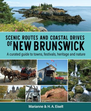
$16.95, PaperbackScenic Routes and Coastal Drives of New Brunswick
Highlights the best stops along New Brunswick’s scenic routes and coastal drives - the villages, festivals and must-see vistas.
$24.95, PaperbackFormac Field Guide to Nova Scotia Birds
A comprehensive guide for the beginner and the experienced birder$24.95, PaperbackInterest ages: 8-15Wildflowers of Nova Scotia, New Brunswick & Prince Edward Island
For anyone who has ever driven a Maritime highway and marveled at the cover of wildflowers along an embankment, or happened on a meadow filled with flowers, this book will provide hours of happy discovery.$19.95, Paperback


